Home » Stories » Historical Stories » Brunker Lake & Brunker Bay By John Dettloff
Brunker Lake & Brunker Bay By John Dettloff
Ever since the first maps of the Chippewa Flowage began listing place names, Bunker Lake and Bunker Bay have long been prominently identified on most maps. But how did these names come to be? Was Bunker a person? If so, who was he?
The first clue to figuring out this mystery is revealed on the original 1911-1912 survey map of the proposed Chippewa Flowage reservoir. Within section 30 (just south of where Pete’s Bar today is located) this map shows the location of a homestead cabin. After studying the cabin’s precise location on the old map, my wife Brenda and I sought out to find it early last spring. It wasn’t long before we found the cabin site… exactly where the map said it should be. What remains is a relatively small depression in the ground surrounded by pieces of concrete, broken bricks, and foundation rocks.
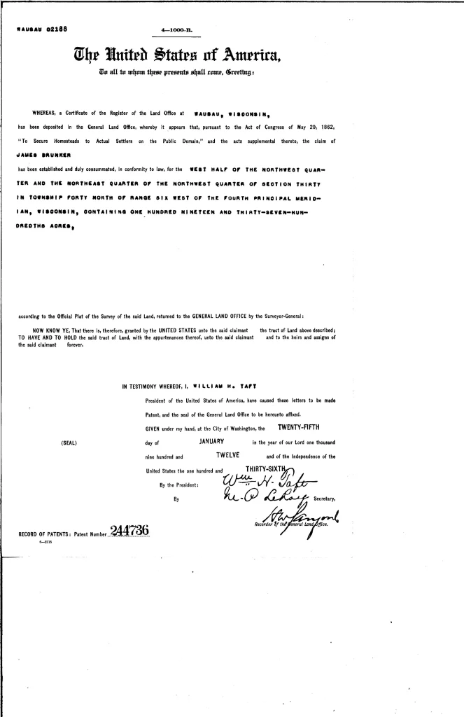
A trip to the courthouse soon revealed who had built this homestead… a man named James Brunker. That’s right, Brunker not Bunker. Land records show, Brunker filed a homestead affidavit (pursuant to the Homestead Act of 1862) with the Land Office in Wausau and built a homestead cabin on a 119 acre parcel of land just to the northeast of a small, unnamed 21 acre lake. It was likely during the summer of 1906 when he built his cabin. Once Brunker proved up on his claim after living there for a minimum of five years he was then issued a land patent for the property on January 25, 1912.
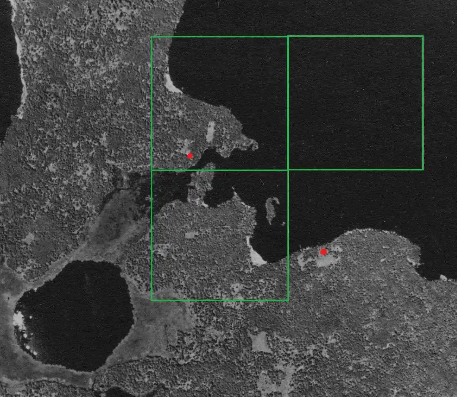
Brunker’s homestead was located about a mile and a half to the northwest of the Trading Post village known as Pahquahwong and he did have a nearby neighbor named Theodore Thoresen who had homesteaded his own place a quarter mile to the southeast several years earlier. On the attached aerial map, James Brunker’s three 40’s are illustrated in green and both his and Thoresen’s homesteads are indicated by the red dots.
Unfortunately for Brunker (and Thoresen), it wouldn’t be long before he began hearing talk of the possibility that he may be losing more than half of his land by the creation of a huge reservoir which happened to be in the planning stages. Not much is known about Mr. Brunker except that he served as the first town chairman of the newly formed Town of Hunter, which first met on April 6, 1915. With the Wisconsin Minnesota Light & Power Company – through its agent Clarence Wise – beginning to purchase lands within the floodplain of the coming Flowage, it wasn’t long before James Brunker was approached with an offer. His sold all three of his 40’s to Wise in August of 1917 and moved on.
Since then, James Brunker seems to have faded into oblivion and it is not known where he ended up. All that now remains of Mr. Brunker is the erroneously named Bunker Lake and Bunker Bay on the Chippewa Flowage. Therefore, in order to correct an age old wrong and properly memorialize James Brunker, the LCFRA has “officially” renamed the two locations on the latest Chippewa Flowage map… Brunker Lake and Brunker Bay.
Share this Story
Homestead Record
Other Historical Places


