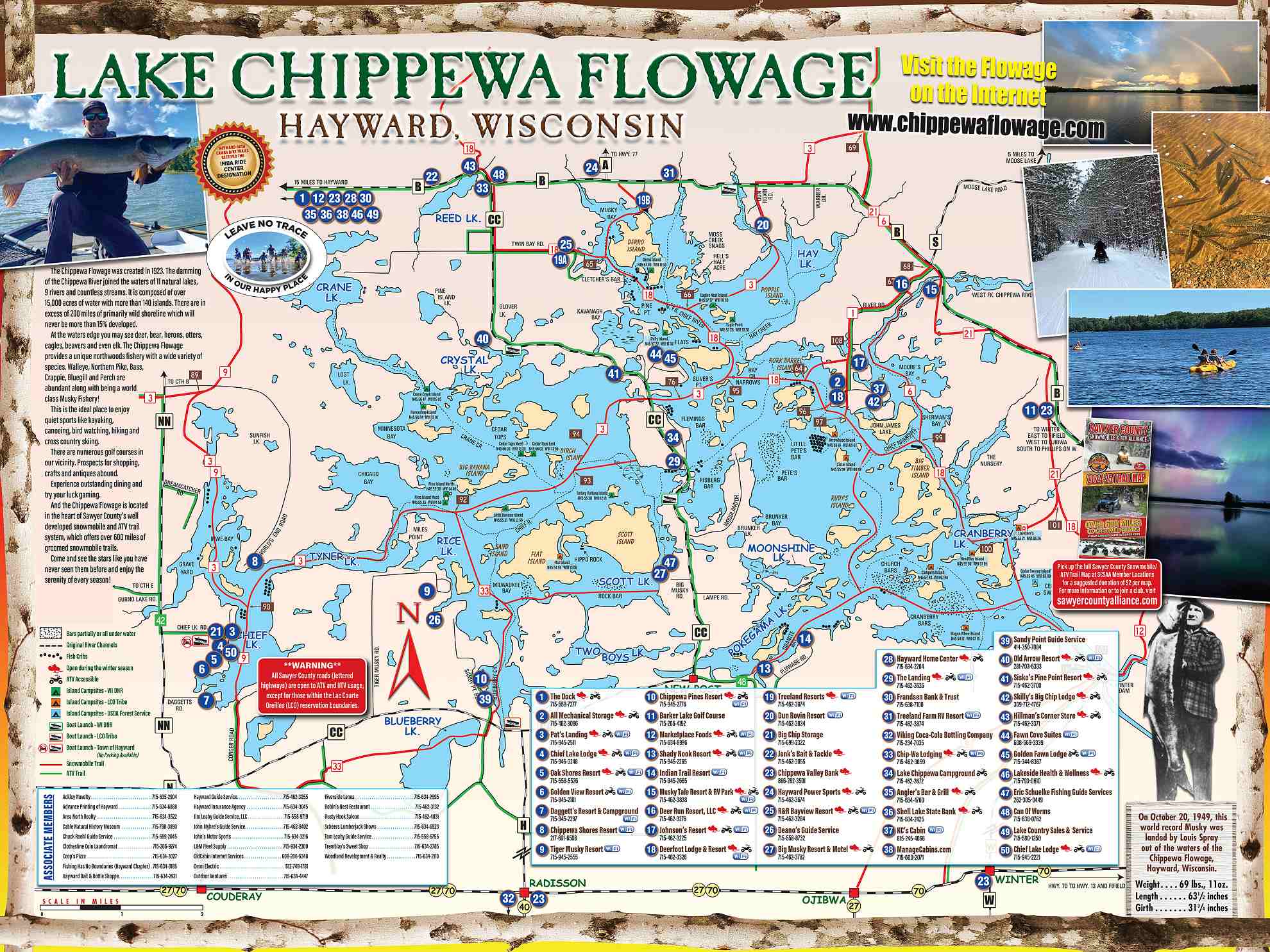
Lake Chippewa Flowage Vacation Map
A lake map is an essential tool for anyone planning to spend time on or near a lake. It is a representation of the lake’s underwater topography, as well as its shoreline and surrounding area. The benefits of having access to a lake map are numerous, and they can greatly enhance your experience on the water.
First and foremost, a map provides valuable information about the lake’s depth and contours. This is crucial for boaters, as it helps them navigate safely and avoid shallow areas or hidden hazards. It also allows them to plan their routes and find the best spots for fishing or water sports. For anglers, a lake map is especially useful as it can reveal the locations of underwater structures, such as drop-offs, points, and weed beds, where fish are likely to congregate.
A map also helps in identifying potential fishing hotspots. By studying the map, anglers can determine the types of fish that inhabit the lake and their preferred habitats. This information can be incredibly useful in selecting the right bait and technique for a successful fishing trip. Furthermore, a map can also indicate the areas that are off-limits for fishing, such as private property or protected areas, ensuring that anglers stay within the legal boundaries.


Our Members
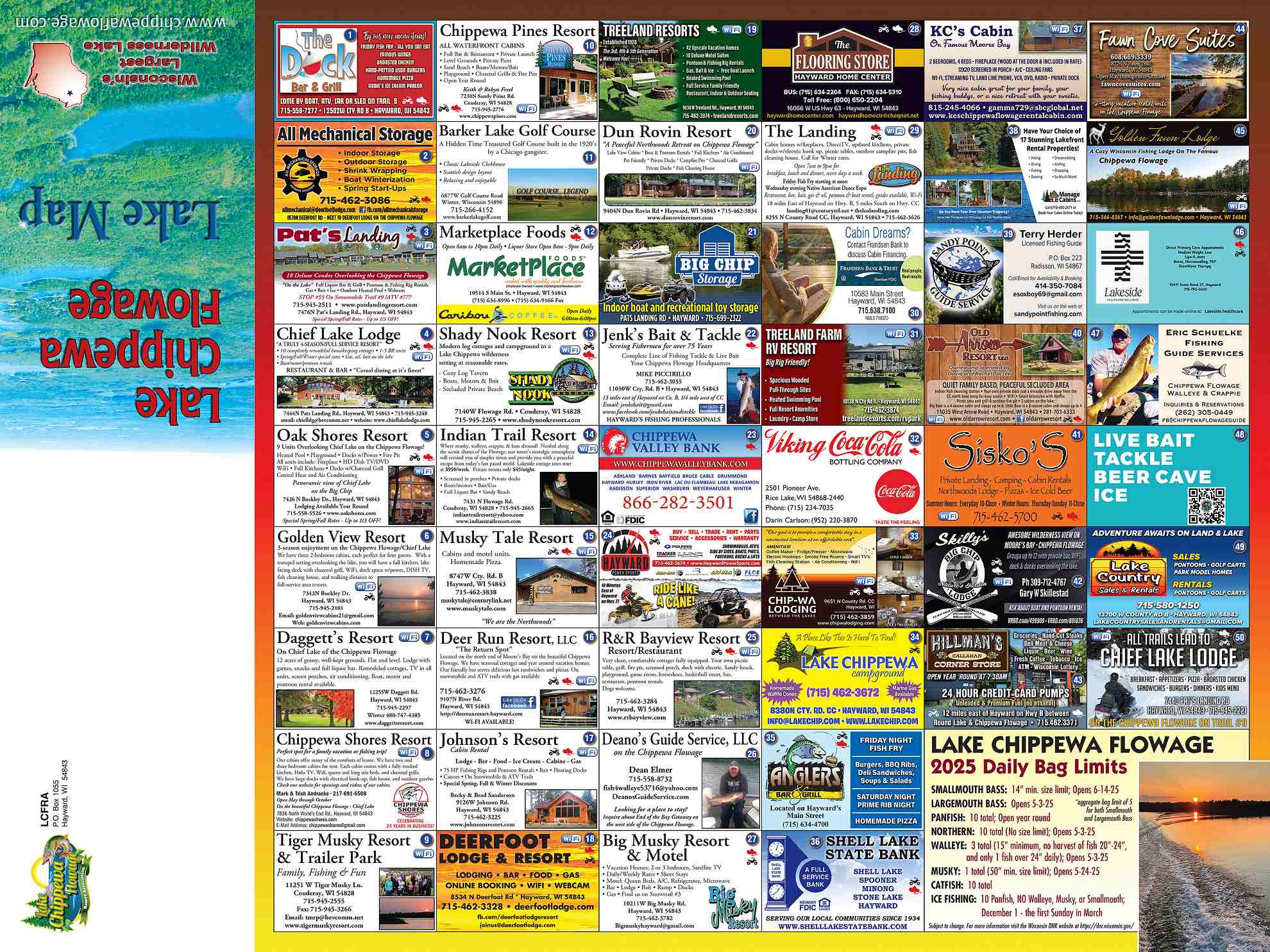
The maps below shows a general map of our members. Some of our members are in more than one category. ie. lodging and dining. Use the menus above to show lists of lodging, dining, etc.
Aside from navigation and fishing, a map can also be a valuable resource for nature lovers and outdoor enthusiasts. It can show the location of hiking trails, campsites, and scenic viewpoints around the lake, allowing visitors to plan their activities and explore the area more efficiently. A lake map can also highlight points of interest, such as waterfalls, historical sites, or wildlife habitats, making it an educational tool for learning about the lake’s ecosystem.
Moreover, a lake map can be a vital safety tool, especially for those who are unfamiliar with the lake. It can help boaters and swimmers identify potential hazards and stay out of danger. For instance, a lake map can indicate where the water is deep enough for diving, or where strong currents or underwater obstacles may be present. This knowledge can prevent accidents and ensure a safe and enjoyable experience on the lake.
In addition to its practical uses, a map can also serve as a memento of your time spent at the lake. Many maps are beautifully illustrated, showcasing the lake’s unique features and landmarks. They can be a great addition to a lake house or cabin, serving as a reminder of the memories made on the water. Furthermore, some lake maps also include information about the lake’s history, geology, and wildlife, making them a valuable educational resource.
In conclusion, lake maps are a valuable tool for anyone planning to spend time on or near a lake. It provides essential information for navigation and fishing, enhances safety, and can also be a source of entertainment and education. Whether you are a boater, angler, nature lover, or simply someone looking to relax by the water, a map is an invaluable resource that can greatly enhance your experience and make your time on the lake more enjoyable.

